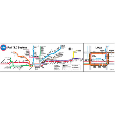
This richly colored, simplified map of the modern CTA ‘L’ system and commuter rail network within its area nods to what some transit/map enthusiasts might recognize from maps published in the Regional Transportation Authority’s early days. This new artwork takes inspiration from maps published by the RTA in the late 1970s that were among the first official, regional transit maps. This map, for simplicity, shows just rail lines with bright colors of today’s ‘L’ routes and green-dashed chartreuse for complementary commuter rail services against, as the RTA’s maps did, a black and olive backdrop with a rich blue for water shown for context. This artwork also nods to the tidy 70s typographical styling RTA’s designers used, use of negative space and playful contrast of the legend over the lake water.
Prints measure 20" x 24" and are available in 2 styles: Poster and Metal Print.
Posters are printed on matte 185gsm paper and can be easily framed in a standard size frame found at most major retailers.
Metal Prints are made of 1.149mm thick aluminum with rounded corners and a dye sublimated high gloss image. They are easily hung via a built in wooden frame mount.